")


Undet voor SketchUp, 1 jaar
€495,00
Functies
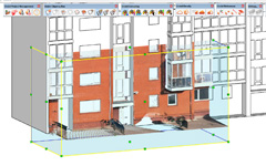
Point cloud clipping box
Tools voor het clippen, slicen en croppen om de weergave van de puntenwolk in de modelweergave te bepalen.
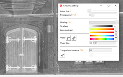
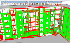
Puntenwolk visualisatie
Visualisatie van puntenwolken & geavanceerde hulpmiddelen voor kleurbeheer om snel de kleinste details van puntenwolken te zien.
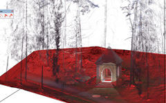
Meshing van grondvlakken
Meshing tools om het grondvlak te extraheren uit niet-geclassificeerde puntenwolk data. Dit gebeurt door het elimineren van bestaande objecten zoals bomen, auto’s en palen.
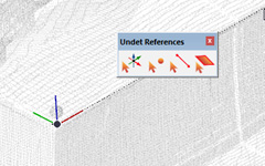
Snapping en referentie
Snapping en referentietools om de as in te stellen op een puntenwolkaanzicht, punten te plaatsen of te verwijzen naar lijnobjecten.
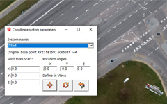
Ondersteuning voor geodata
Geodatatools voor het importeren van puntenwolken volgens het coördinatenstelsel. Roteer en verplaats de puntenwolk naar de as of het bestaande model.
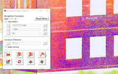
Automatische extractie
Automatische extractietools voor het nauwkeurig extraheren, extruderen en aanpassen van het SketchUp vlak op de puntenwolken.
Textureren & orthofoto
Textuurtools om de gerenderde weergave van de puntenwolk op het geselecteerde vlak toe te passen.
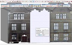
3D Model inspectietools
Inspectietools om uw 3D model te vergelijken met de puntenwolk om de nauwkeurigheid te controleren.
UNDET quickly locates and visualizes point cloud views of any size in the SketchUp environment, regardless of the 3D measurement equipment and photogrammetry software used: Faro, Trimble, Leica, Z+F, Reigl, Topcon, DOT Product, PIX4D, Autodesk Recap, Agisoft, RealityCapture, DroneDeploy, 3DF Zephyr…
Supported point cloud formats: *.E57, *.FLS, *.RCP, *.PTX, *.ZFS,*.LAS, *.LAZ, *.PTS, *.DP, *.FPR, *.LSPROJ, *.FWS, *.CL3, *.CLR, *.RSP, ASCII / NEZ (X,Y,Z/i/RGB) and custom ASCII / TXT file format imports.

Undet + SketchUp
Probably the easiest and fastest way to create 3D models based on point cloud data for those who love the simplicity of SketchUp.
The UNDET plugin has a user-friendly interface and intuitive workflow for those without specific 3D modelling knowledge.
Extra informatie
| Besturingssysteem | Windows |
|---|---|
| Versie | Subscription, Plugin |